
Arnarstapi Coastal Walk
Basalt cliffs, sea arches, and a troll guardian on Snæfellsnes
Practical Tips
- June–August for puffins and 24-hour daylight; spring and autumn are quieter with fewer people
- Free to walk — no entrance fee; free parking and public toilets at Arnarstapi harbour
- 2.5 hours from Reykjavík via Route 1 west, then Route 54; no public transport on the peninsula
- Sturdy walking shoes — lava rock is uneven and sections are rocky; windproof layer is essential
- Fjöruhúsið café in Hellnar serves fish stew and fresh bread with ocean views; open April–October
- Fulmars, kittiwakes, Arctic terns, and puffins nest along the cliffs from April to August
- Path runs unfenced along cliff edges for most of its length — stay back in strong wind
- Winter: walkable but short daylight, café closed, path can be icy; the rough seas are dramatic
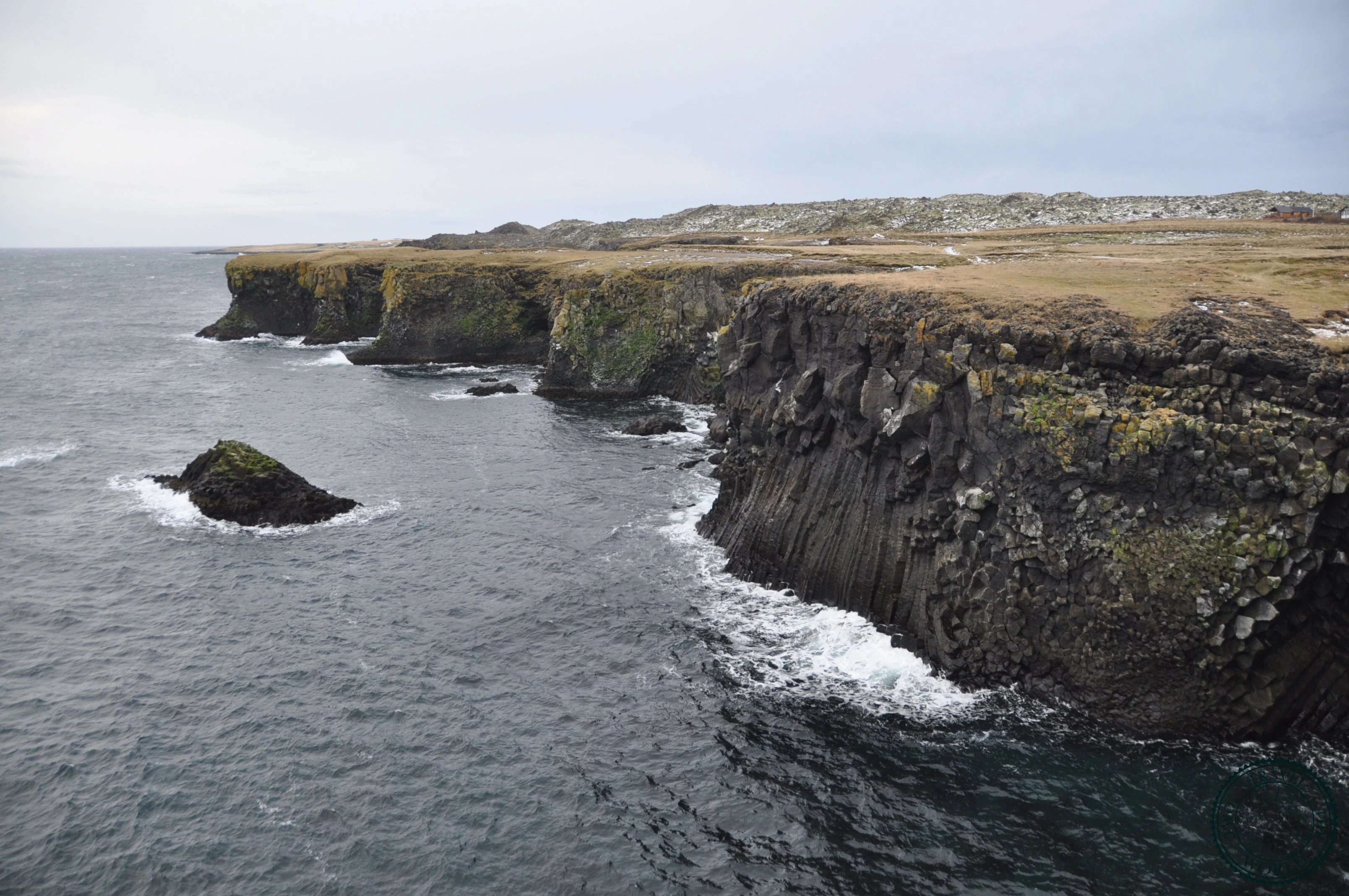
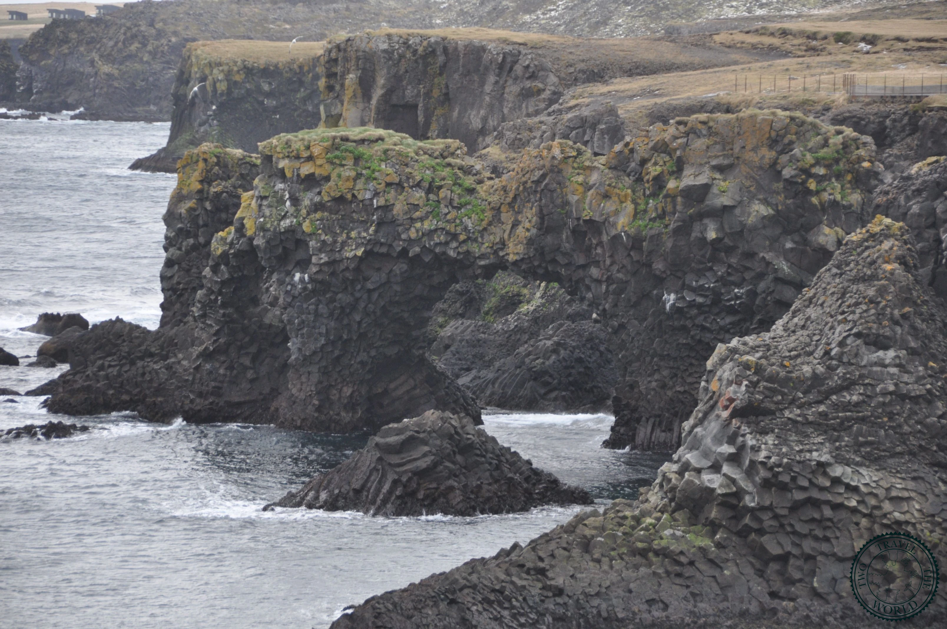
The walk from Arnarstapi to Hellnar is 2.5 km of some of the most compressed geology in Iceland — columnar basalt shaped by the Atlantic into arches, caves, and formations that look like something between a cathedral and a wreck. You start beside a six-metre stone figure watching the harbour and finish at a small café built into a fisherman's hut, with the ocean visible through every window.
The cliff edge path
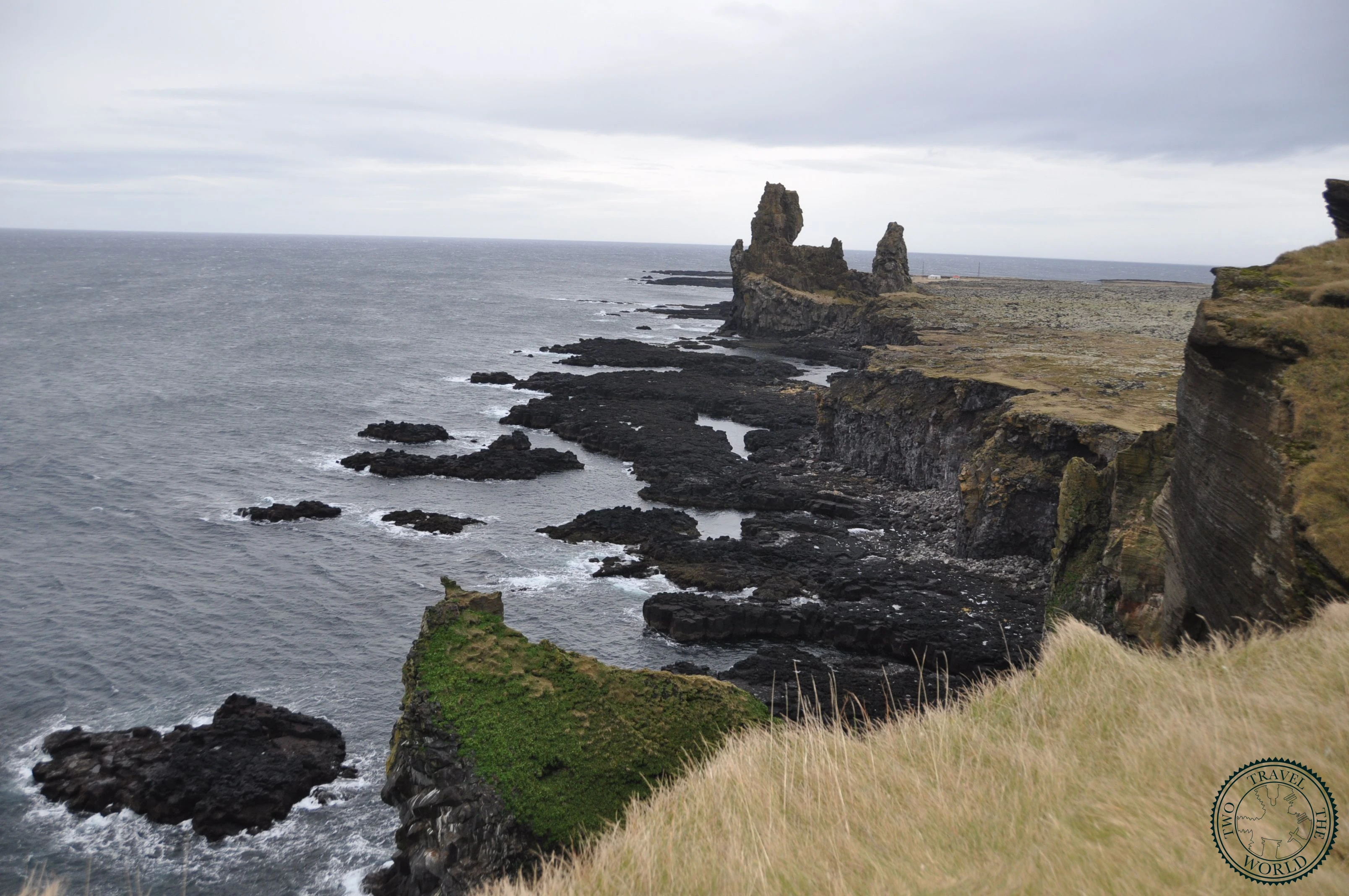
The village of Arnarstapi sits on the southern coast of Snæfellsnes, directly beneath the Snæfellsjökull glacier. It was a trading port under Danish Crown control from 1565 and had around 150 residents at its peak in the early eighteenth century — remarkable for a place that today has a handful of houses, one harbour, and a car park. What it does have is one of the few natural harbours on this stretch of Iceland's coastline, and the geology that created it is the same geology that makes the walk so striking.
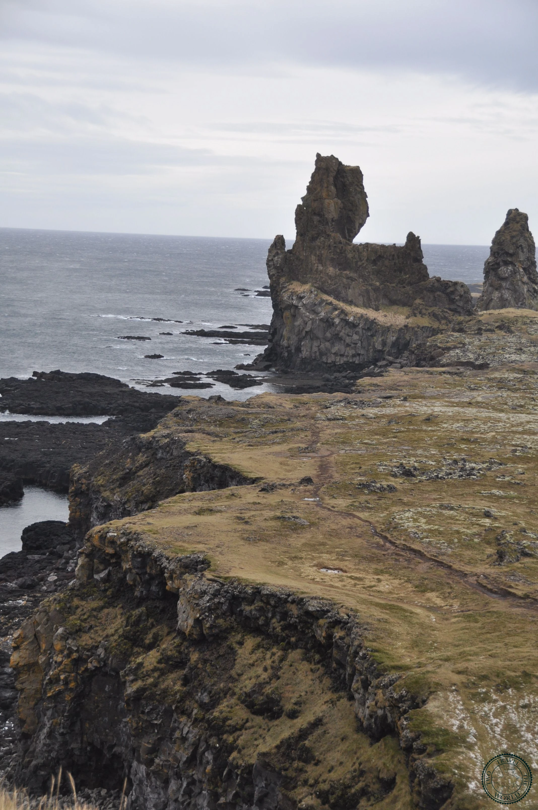
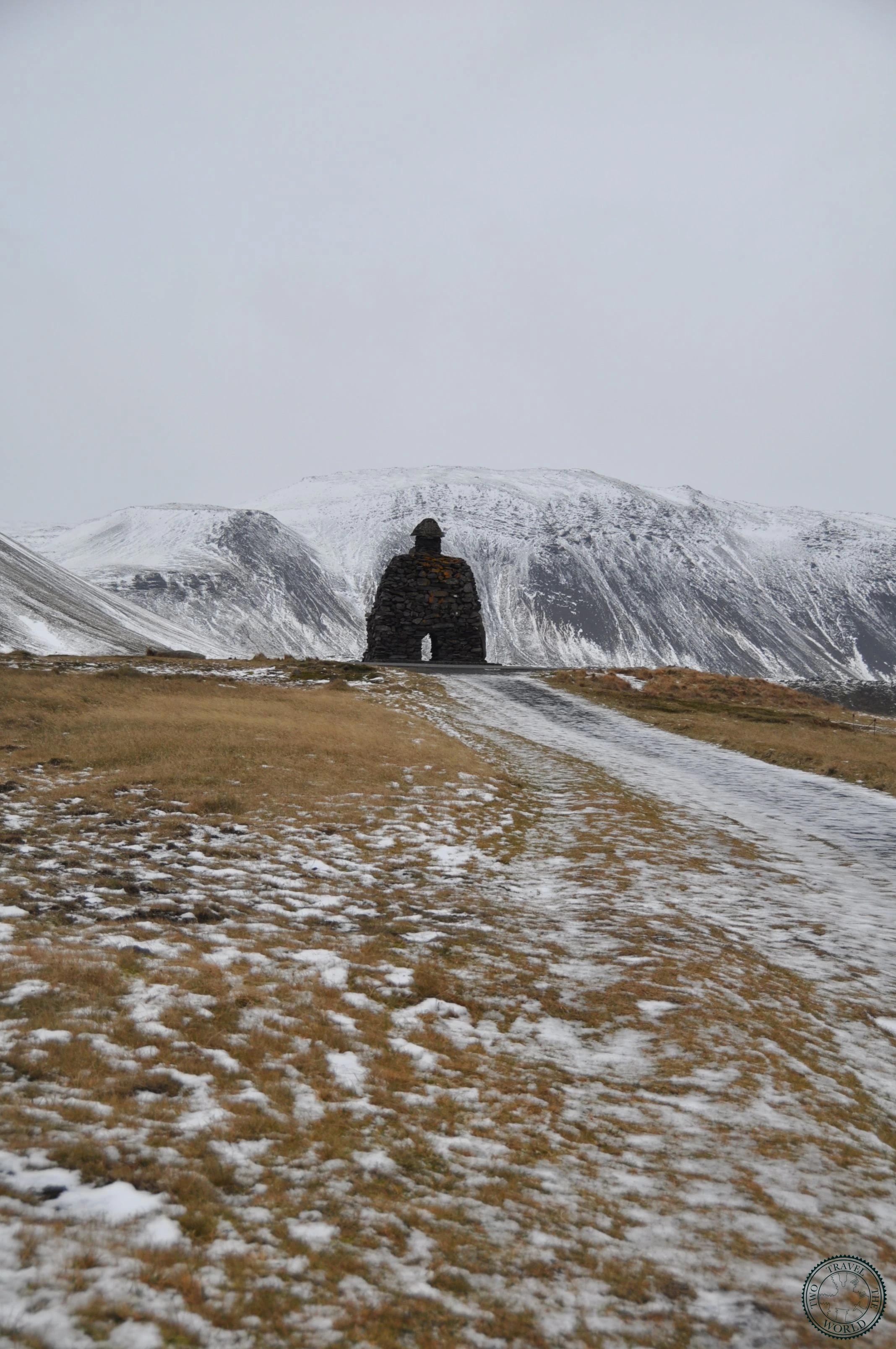
The trail starts beside the Bárður Snæfellsás statue and runs south along the cliff top toward Hellnar. The path is well-marked and mostly flat, with the glacier at your back and the Atlantic below. About half the trail is groomed; the rest is rocky lava surface, uneven enough that you notice it underfoot. There are no fences along the cliff edge.
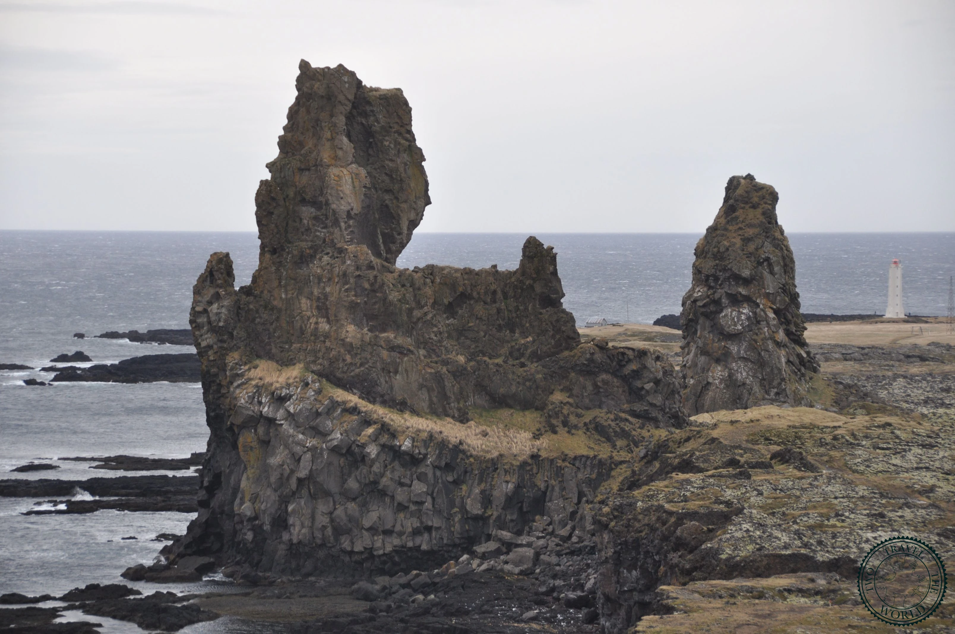
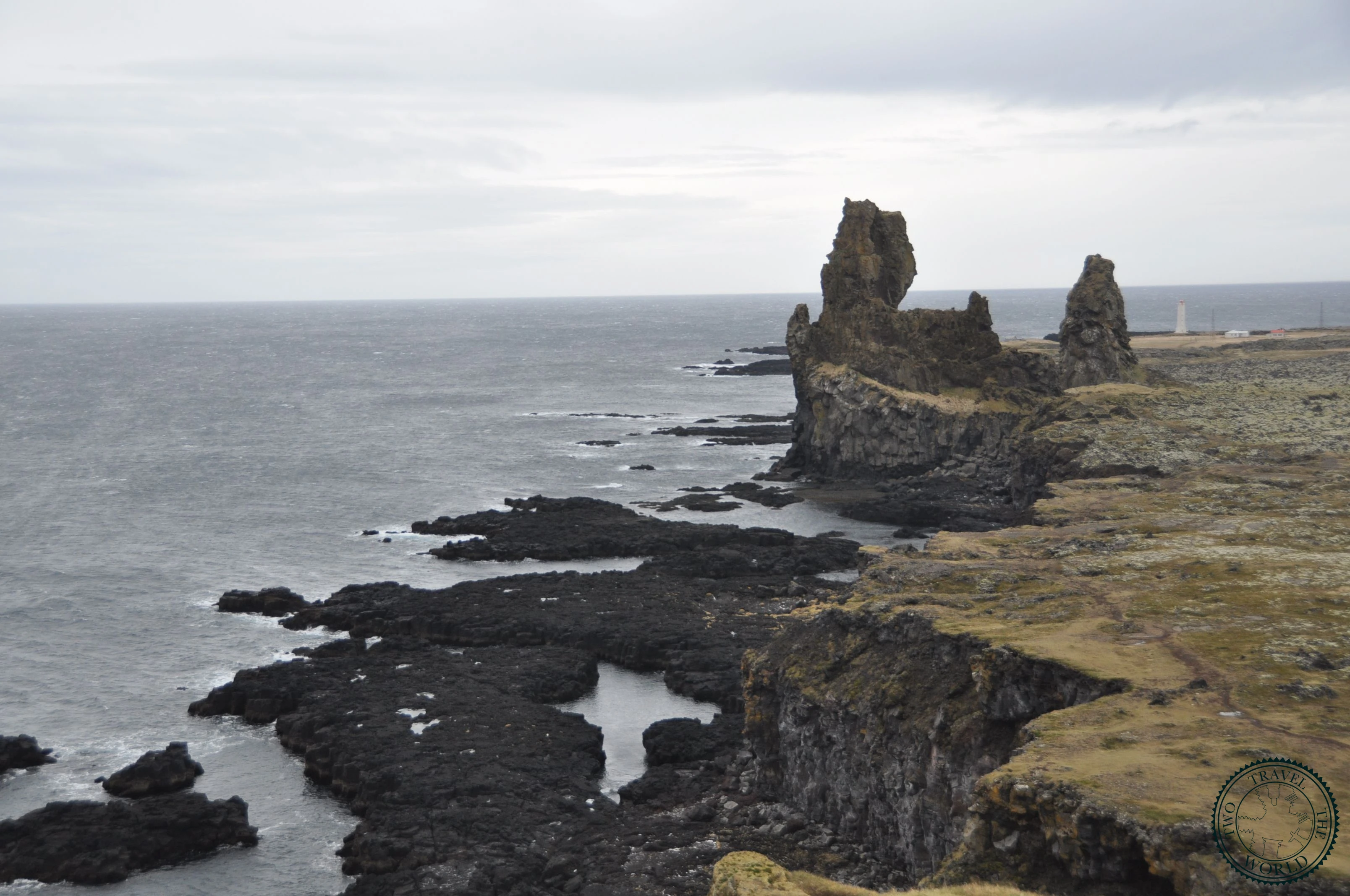
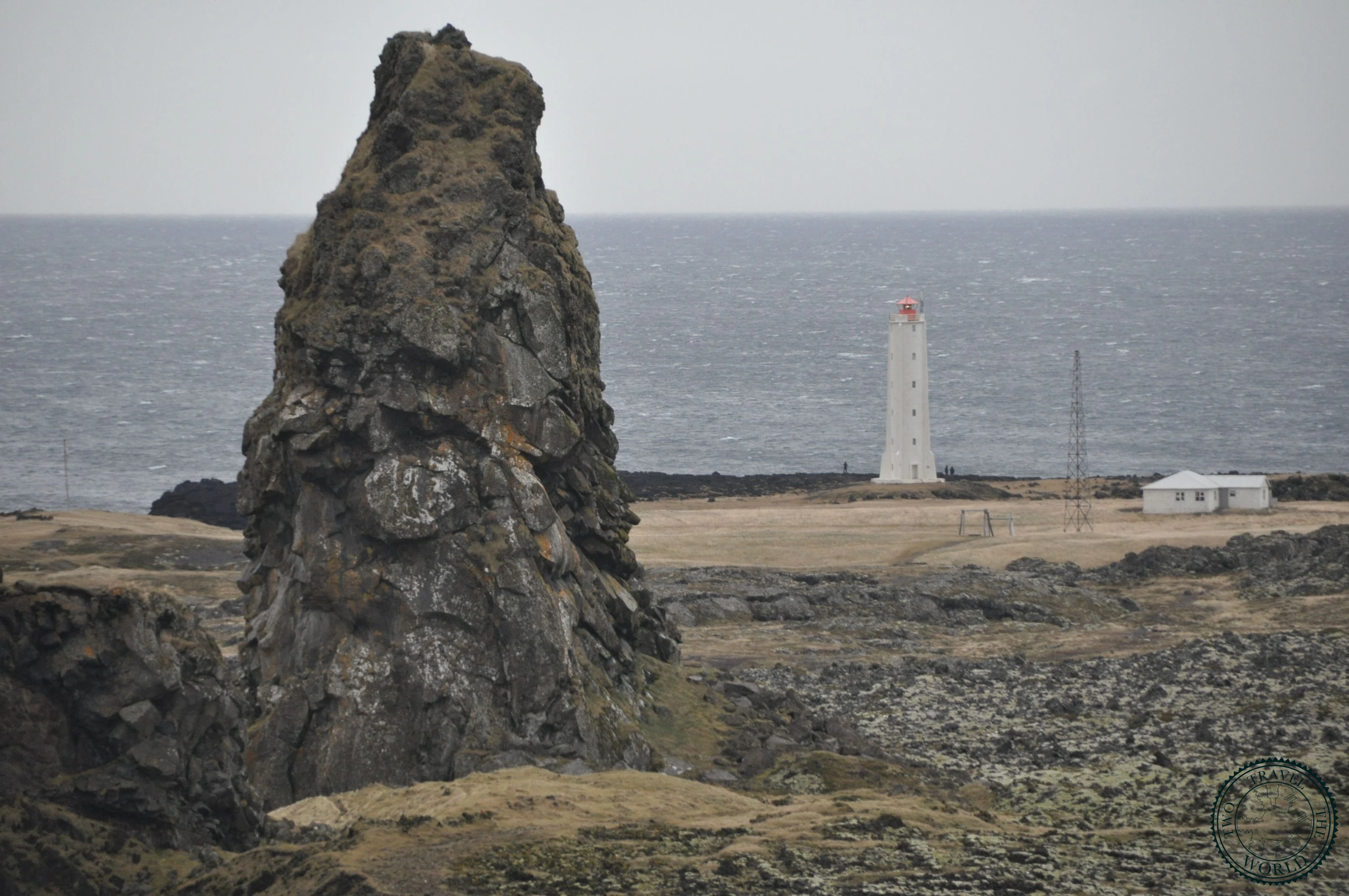
Gatklettur is the main event — a basalt arch that formed as Atlantic wave action gradually carved away the weaker sections of the volcanic cliff face over thousands of years. The stronger columnar rock held; the rest didn't. The result is a natural arch large enough to frame a clear view of the ocean, with fulmars circling through it on calm days and spray shooting up through it on rough ones. From the path, the trail drops slightly near Gatklettur to give you a clear line of sight through the arch to the water beyond.


In summer, the cliffs between Arnarstapi and Hellnar are thick with nesting seabirds — fulmars and kittiwakes in every crevice, Arctic terns diving over the path, and puffins returning to their burrows from May through late August. On a clear day, the contrast between black basalt, white surf, and the green moss covering the inland side of the lava is the kind of thing that makes you stop walking and just look for a while.
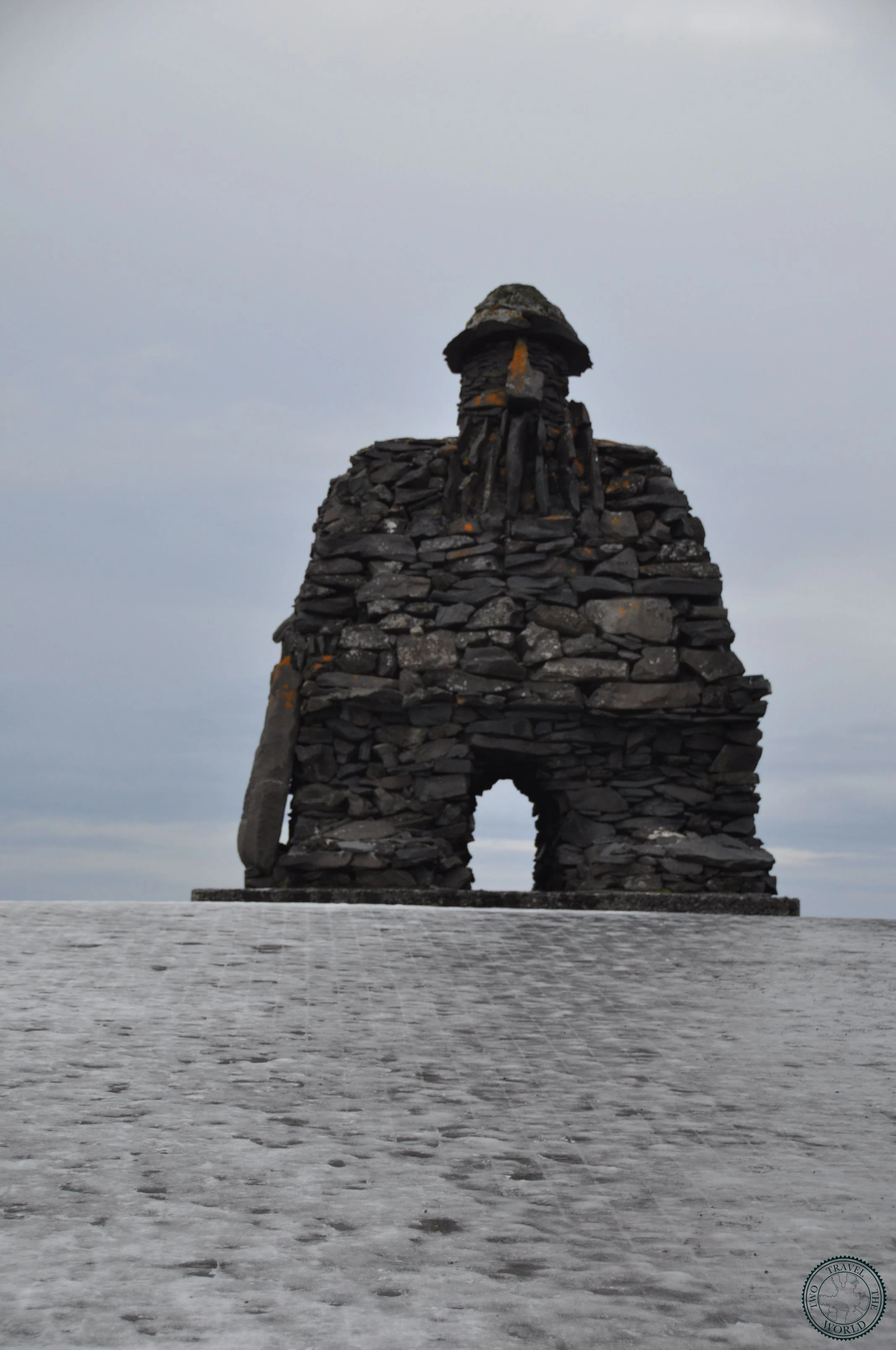
The statue at the trailhead is worth a minute. Bárður Snæfellsás — half human, half troll according to the saga written in the early fourteenth century — settled this stretch of Snæfellsnes after fleeing Norway. The story that follows is not a comfortable one: when his nephew pushed his daughter out to sea on an iceberg, Bárður revenged himself by throwing the nephew into a nearby ravine and casting another off a sea cliff. Consumed by grief, he gave away his land and vanished into the Snæfellsjökull glacier. He became the guardian spirit of the peninsula — people prayed to him in times of hardship for centuries after.
The statue, carved by sculptor Ragnar Kjartansson and unveiled in 1978, stands six metres tall in dark basalt, holding a large stone. It is not subtle, but it suits the landscape. The figure looks out over the same harbour that functioned as a Danish Crown commercial outpost for two centuries, and the same cliffs where fulmar nests now occupy crevices that were once used for storing fish.
Arnarstapi to Hellnar, and Back
The path runs unfenced along cliff edges for most of its length. Wind can arrive suddenly even when the inland weather seems calm — gusts off the Atlantic along this coast are strong enough to be dangerous close to the edge. If it is blowing hard, keep well back. The Icelandic phrase is apt: the sea does not negotiate.
Arnarstapi → Hellnar
The walk out follows the cliff south. You pass several viewpoints before reaching Gatklettur — the closer you get, the more scale you understand. Beyond the arch, the path continues through lava fields to the small church at Hellnar. The Fjöruhúsið café sits beside it in a converted fisherman's hut, open from April to October. The fish stew is genuinely good, and you can sit at an outdoor table with the surf breaking a few metres below.
The return walk
Most people walk back rather than arranging a pickup, and the return is worth it. The views are different in the other direction — the glacier is now in front of you instead of behind, the light hits the basalt from the opposite angle, and you notice details you missed the first time. The whole round trip takes two to three hours at an easy pace, including time at Gatklettur.

The walk is at its best in June and July when the cliffs are loud with seabirds and the light barely leaves, but it is not a summer-only experience. In winter the Fjöruhúsið is closed and the daylight is short, but the coast strips back to something rawer — rough seas, empty path, ice on the lava, the glacier white against a grey sky. You get the place entirely to yourself.
However you time it, the walk back tends to change your impression of the walk out. The arch looks different from the other side. The glacier, which was behind you the whole way down, now fills the view ahead. Walking toward Snæfellsjökull on the return, you stop thinking of the trail as something you are passing through.
The views are different in reverse — the glacier fills the view ahead and the basalt catches the light from the other angle entirely.
Photo Gallery


More Experiences in Reykjavik

Blue Lagoon
We'll be honest — we went in sceptical about the hype and the price tag. But floating in milky-blue water surrounded by black lava rock at 8 AM, with steam rising into the cold air and hardly anyone else around, won us over.
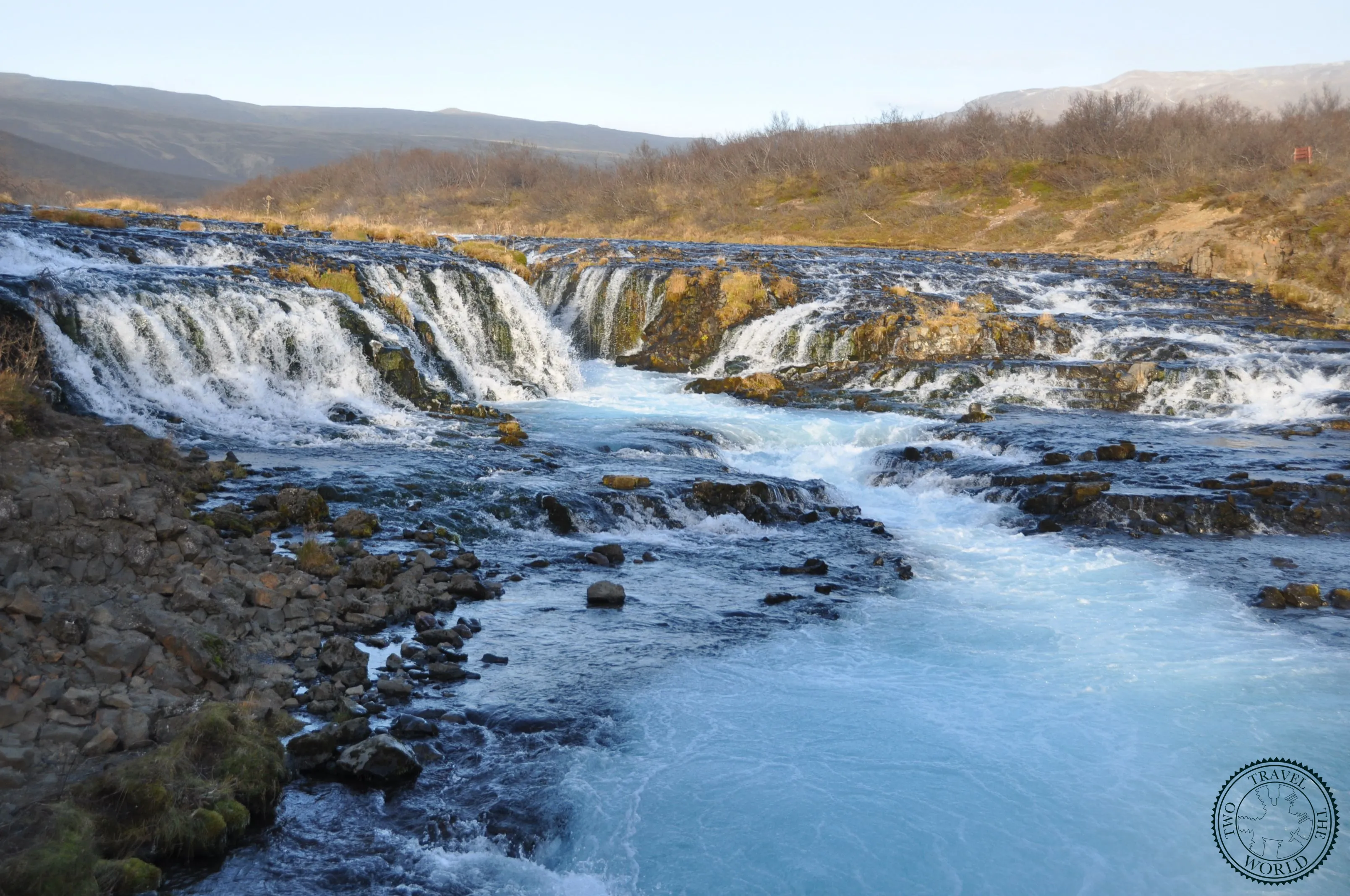
Brúarfoss
Brúarfoss might be the most vivid blue waterfall in Iceland — glacial meltwater from Langjökull filters through lava rock and emerges an almost unreal turquoise, cascading across a wide rocky shelf in a series of braided channels.

Eiríksstaðir Viking Museum
Eiríksstaðir is a reconstructed Viking longhouse in the Dalir region of West Iceland — the former homestead of Erik the Red and likely birthplace of his son Leif Eiríksson, the first known European to reach the Americas. A guide in period dress tells the sagas by an open fire.
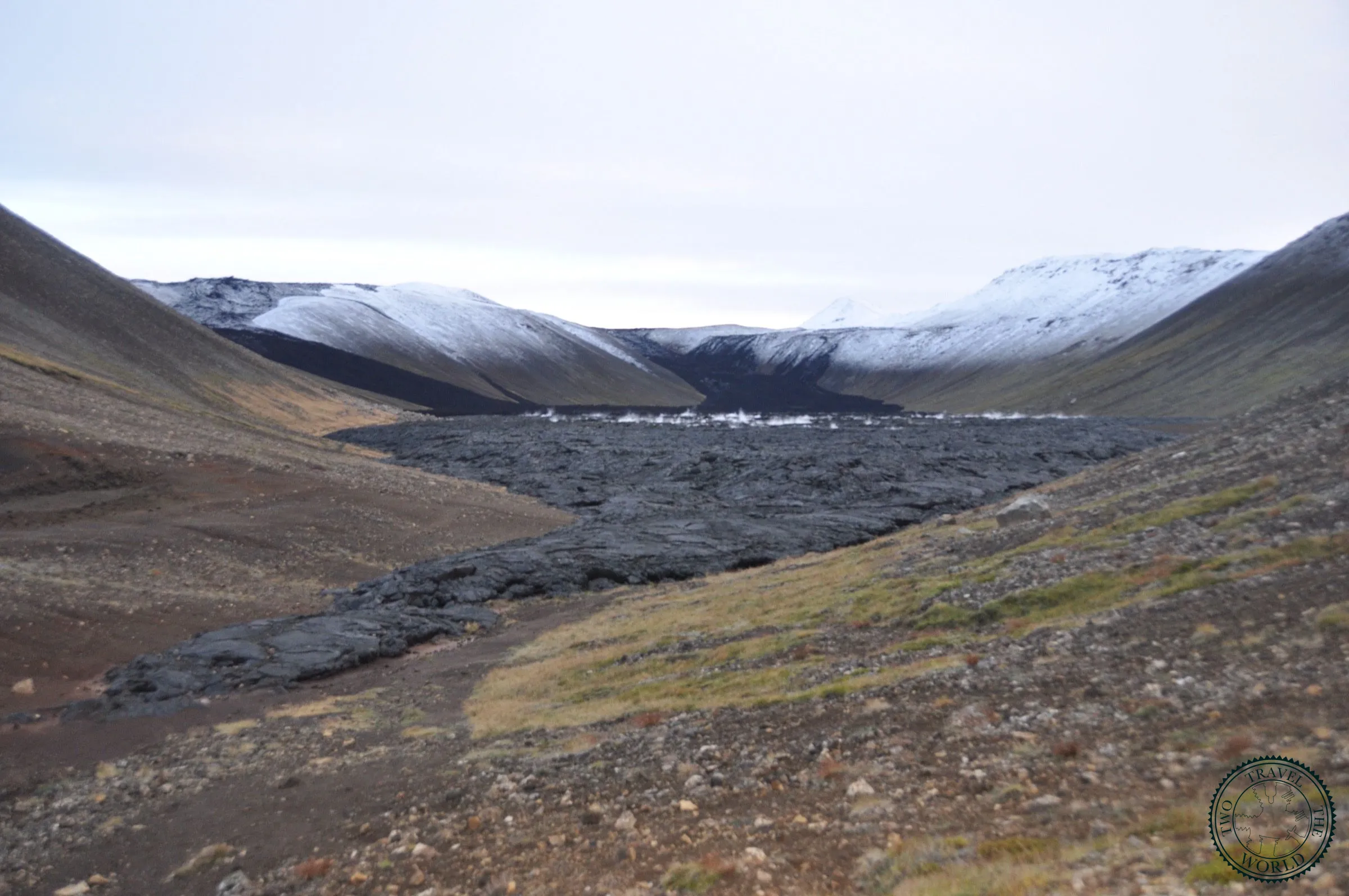
Fagradalsfjall Volcano Trail
The Reykjanes Peninsula eruptions reshaped this landscape between 2021 and 2025 — walking across still-warm lava fields with steam rising from cracks is about as close to another planet as you'll get without leaving Earth.

Gullfoss
Gullfoss drops 32 metres in two dramatic stages before vanishing into a narrow canyon — stand at the lower viewpoint and the sheer force of the Hvítá river hits you in the chest, along with a fair amount of spray.

Öxarárfoss
Öxarárfoss drops 20 metres into the Almannagjá rift at Þingvellir National Park — a waterfall set literally between the North American and Eurasian tectonic plates, in the same gorge where Iceland's parliament was founded in 930 AD.

Strokkur Geyser
Strokkur erupts every 5 to 10 minutes, launching a column of boiling water up to 30 metres into the air — it's Iceland's most reliable geothermal performance, and watching the bubble form and burst never gets old, no matter how many times you see it.