Fagradalsfjall Volcano Trail
Walk across lava fields shaped by eruptions from 2021 to 2025
About This Experience
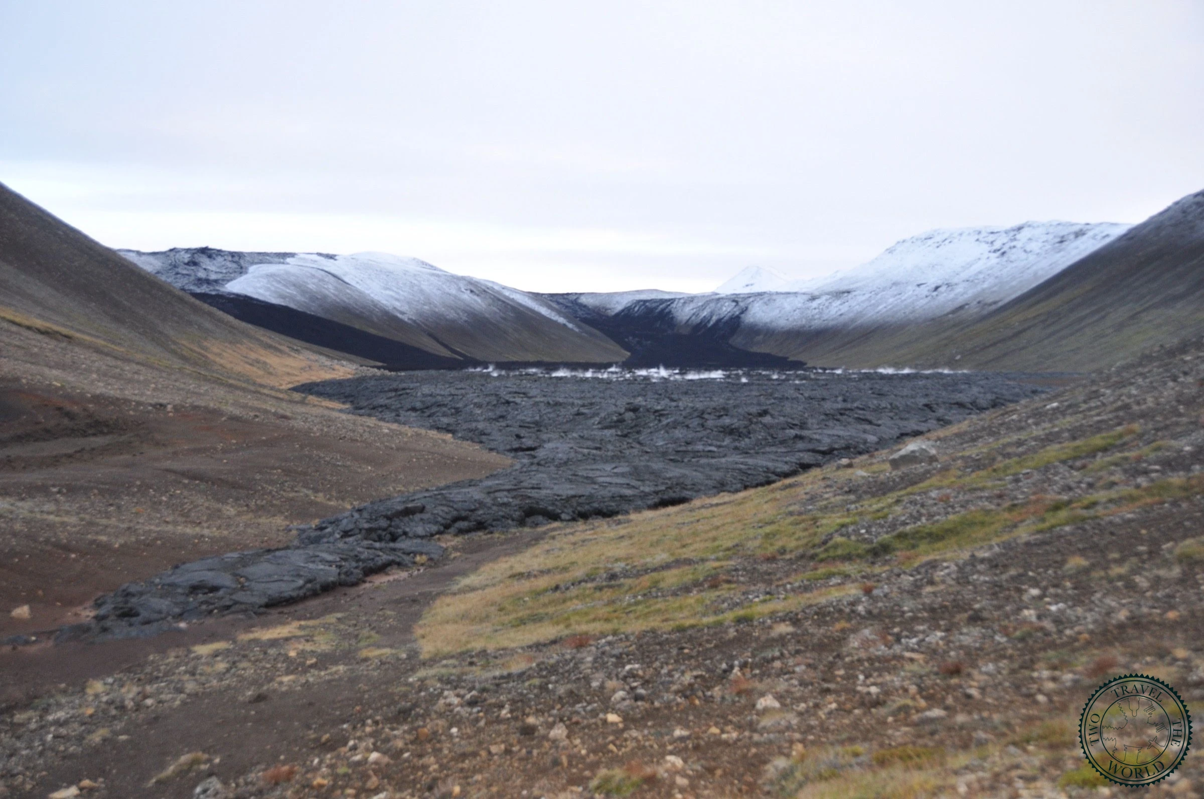
Between 2021 and 2025, a series of volcanic eruptions on the Reykjanes Peninsula completely transformed the landscape around Fagradalsfjall. What was once a relatively unremarkable stretch of moss-covered lava is now a raw, otherworldly terrain of twisted rock, still venting steam in places, barely 40 minutes from Reykjavik.

We weren't sure what to expect — we'd seen the drone footage during the eruptions, but walking across the solidified lava in person is something else entirely. The rock is jet black, rippled and folded like frozen waves. In some places you can feel warmth through your boots. The scale of it only hits you when you reach one of the higher viewpoints and realise how far the lava travelled.
This isn't a polished tourist attraction. The trails shift as conditions change, and the landscape is still geologically active. That rawness is exactly what makes it special.


What to Expect
The main trailhead is at Parking P1 near Grindavik (follow signs for Fagradalsfjall / Litli-Hrútur). The hike to the main lava field viewpoint takes about 45-60 minutes each way, with roughly 200 metres of elevation gain. The path is marked with stakes but crosses uneven terrain — proper hiking boots are essential.
Once you reach the lava field, you can explore along marked routes that wind between the different eruption sites. The 2023 Litli-Hrútur eruption area and the original 2021 Geldingadalur crater are the most impressive sections. Steam vents hiss from cracks in the rock, and the colour palette shifts between pitch black, rust red, and sulphur yellow.

The trail conditions depend heavily on recent volcanic activity — always check safetravel.is before heading out. When we visited, the trails were open and well-marked, but sections can close without notice if seismic activity picks up.
Practical Tips
- Check safetravel.is and the Icelandic Met Office on the morning of your hike — trail status can change overnight
- Wear proper hiking boots with ankle support; the lava rock is sharp and uneven
- Bring layers — it's exposed and windy, even when Reykjavik is calm
- The hike is about 7-8 km round trip with moderate elevation gain
- Start early to avoid afternoon crowds and wind
- No facilities at the trailhead — use the toilets in Grindavik before driving up
- Carry water and snacks; there's nothing on the trail
- The drive from Reykjavik takes about 40 minutes via Route 43
- Do not stray from marked paths — the ground can be unstable near steam vents
- Gas levels can be hazardous in low-lying areas; if you smell strong sulphur, move to higher ground
Photo Gallery


More Experiences in Reykjavik

Arnarstapi Coastal Walk
The coastal path between Arnarstapi and Hellnar follows the edge of the Snæfellsnes Peninsula for 2.5 km past basalt columns, sea arches, and bird cliffs. At one end, a half-troll's statue watches over the harbour. At the other, a small café serves fish stew with an ocean view.

Blue Lagoon
We'll be honest — we went in sceptical about the hype and the price tag. But floating in milky-blue water surrounded by black lava rock at 8 AM, with steam rising into the cold air and hardly anyone else around, won us over.
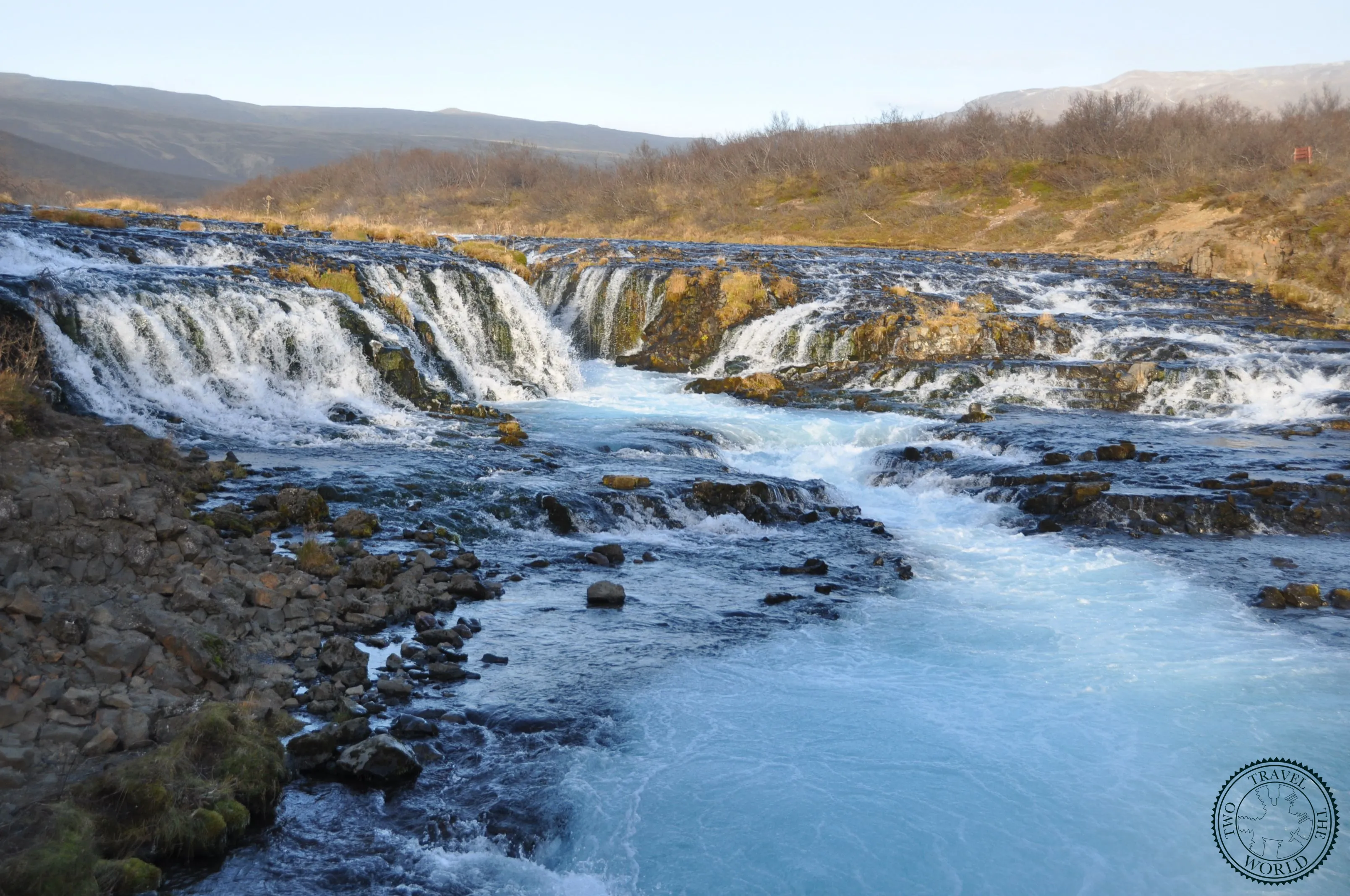
Brúarfoss
Brúarfoss might be the most vivid blue waterfall in Iceland — glacial meltwater from Langjökull filters through lava rock and emerges an almost unreal turquoise, cascading across a wide rocky shelf in a series of braided channels.

Eiríksstaðir Viking Museum
Eiríksstaðir is a reconstructed Viking longhouse in the Dalir region of West Iceland — the former homestead of Erik the Red and likely birthplace of his son Leif Eiríksson, the first known European to reach the Americas. A guide in period dress tells the sagas by an open fire.

Gullfoss
Gullfoss drops 32 metres in two dramatic stages before vanishing into a narrow canyon — stand at the lower viewpoint and the sheer force of the Hvítá river hits you in the chest, along with a fair amount of spray.

Öxarárfoss
Öxarárfoss drops 20 metres into the Almannagjá rift at Þingvellir National Park — a waterfall set literally between the North American and Eurasian tectonic plates, in the same gorge where Iceland's parliament was founded in 930 AD.

Strokkur Geyser
Strokkur erupts every 5 to 10 minutes, launching a column of boiling water up to 30 metres into the air — it's Iceland's most reliable geothermal performance, and watching the bubble form and burst never gets old, no matter how many times you see it.