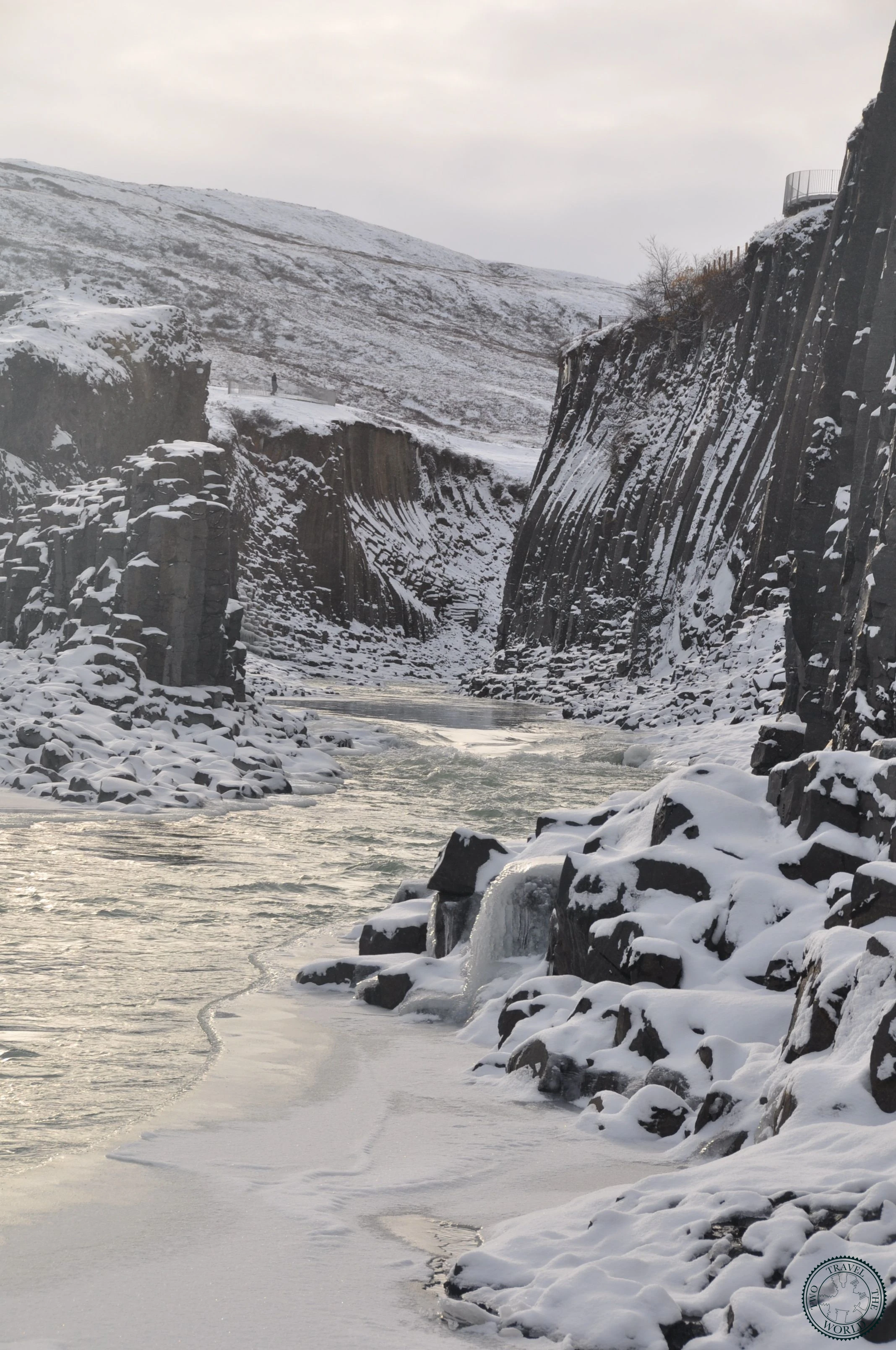
Stuðlagil Canyon
Towering basalt columns and turquoise water — the highlight of East Iceland
About This Experience
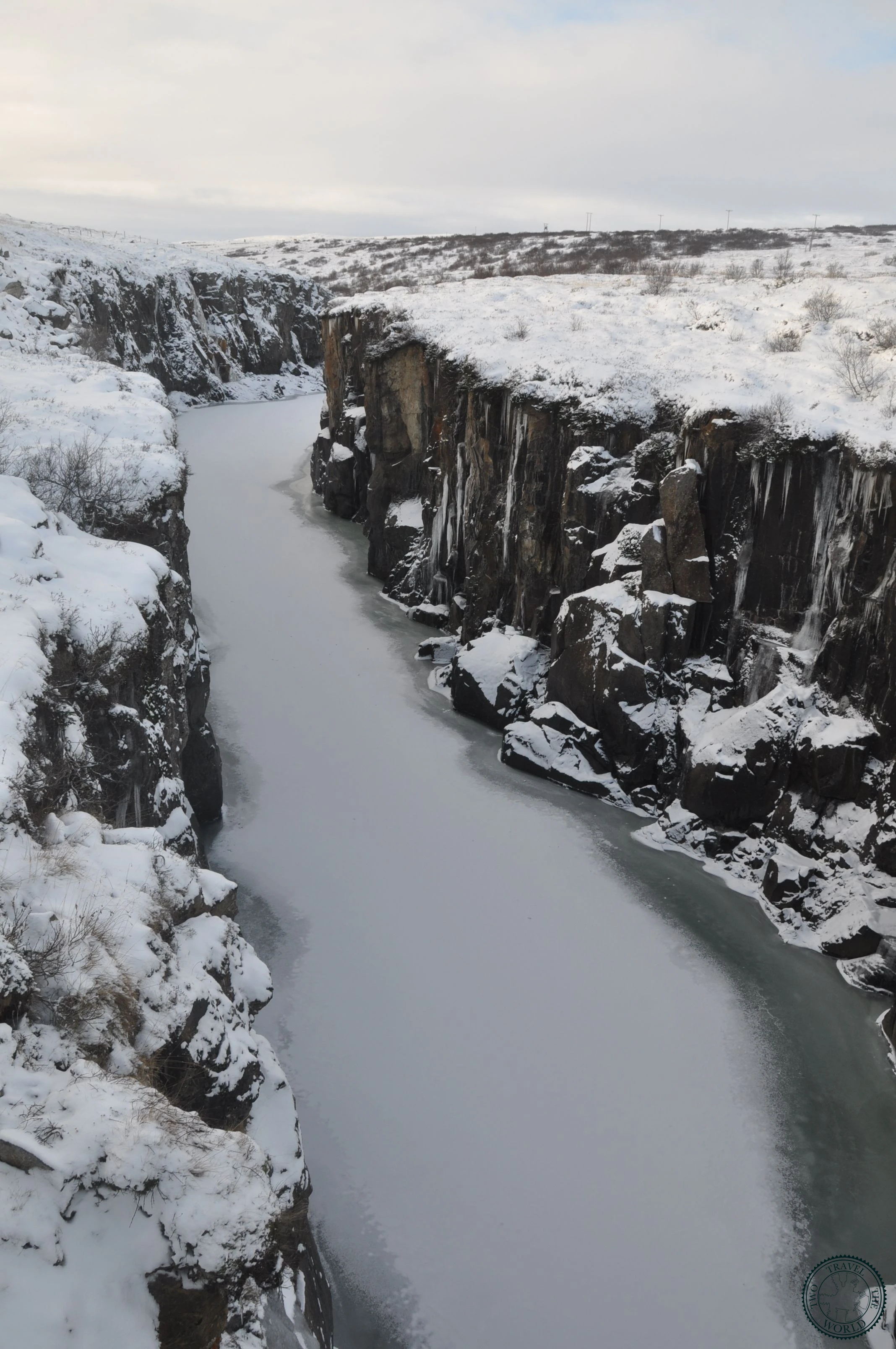
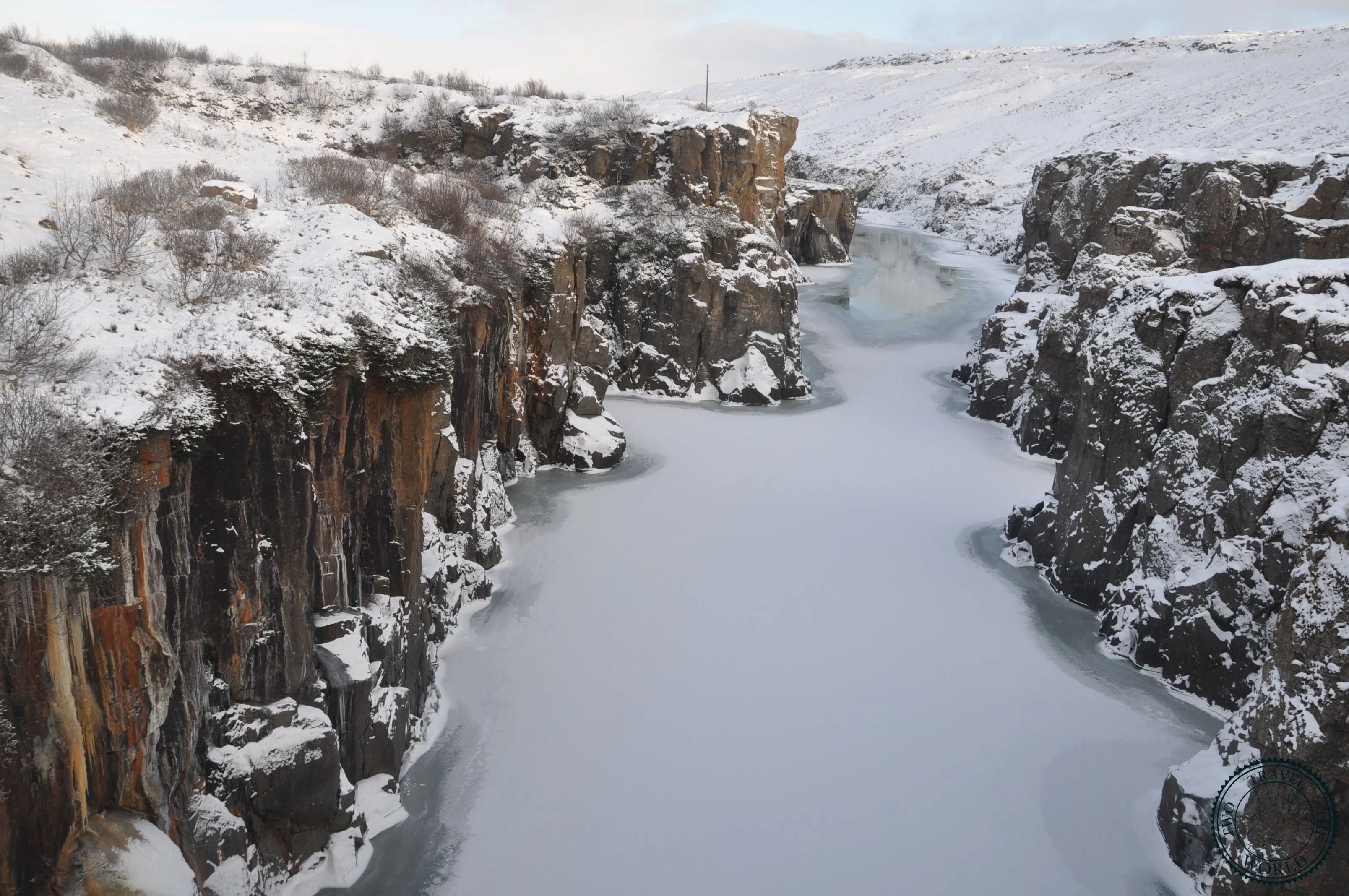
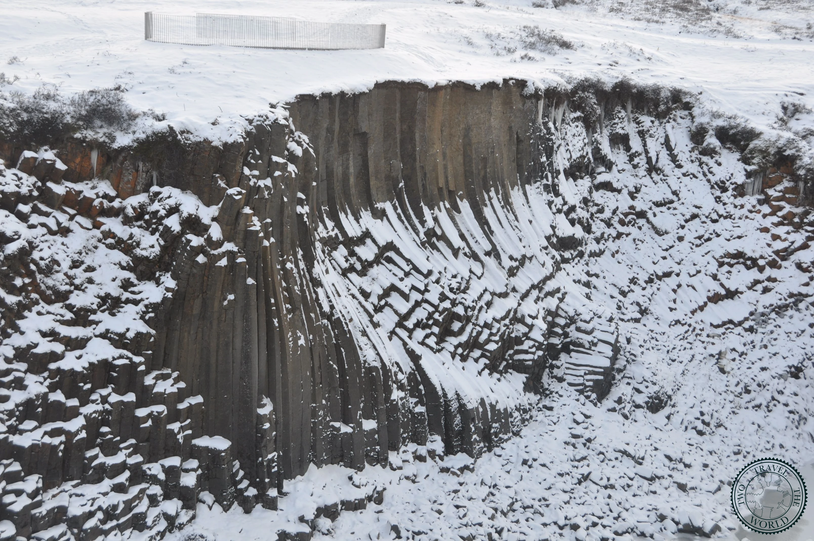
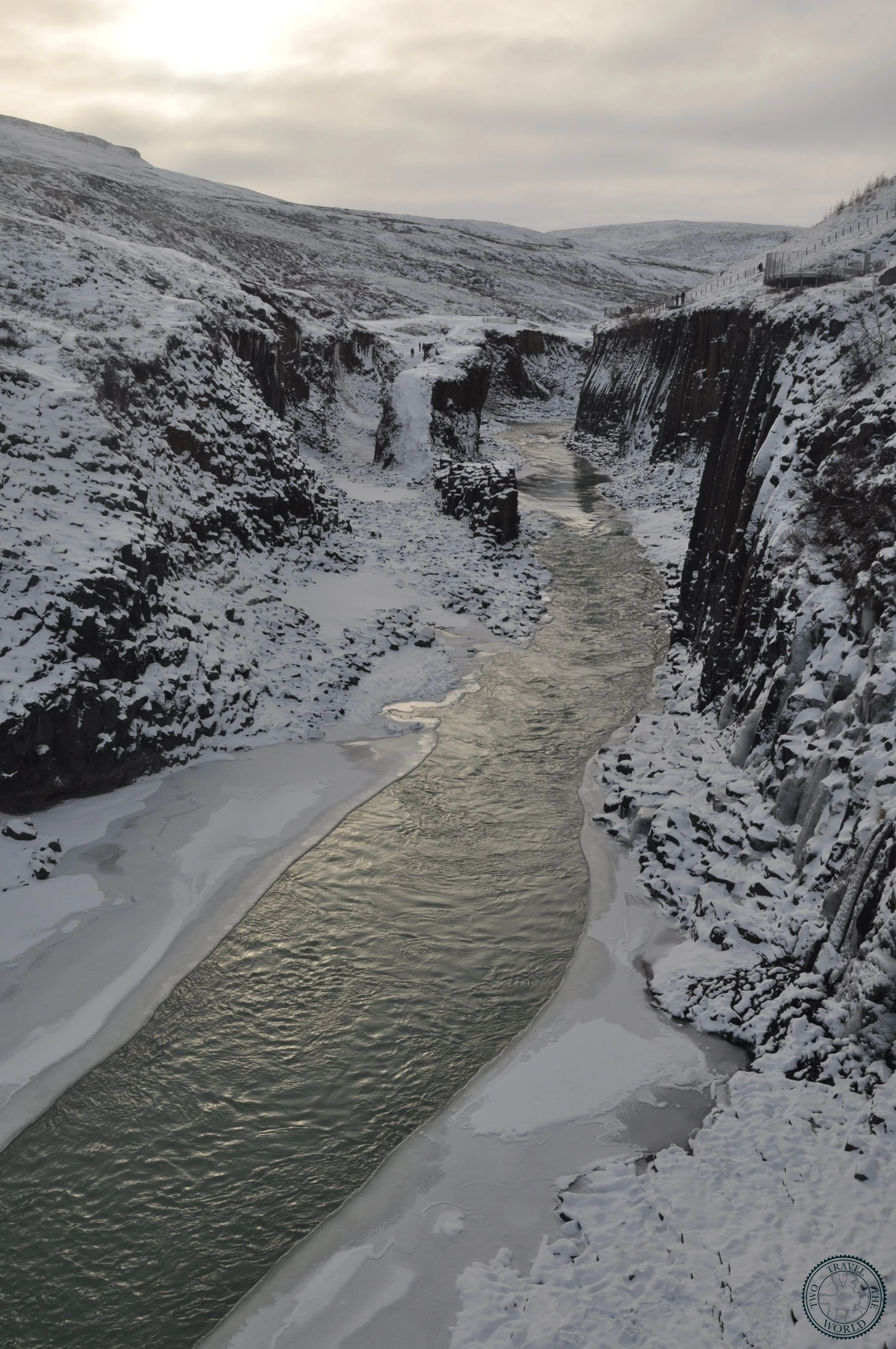
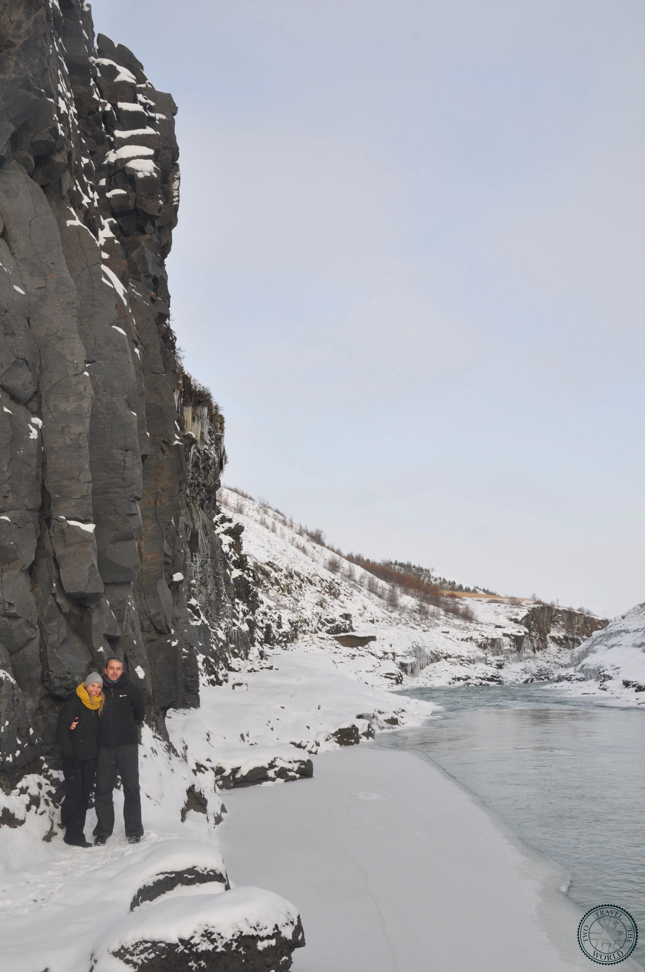
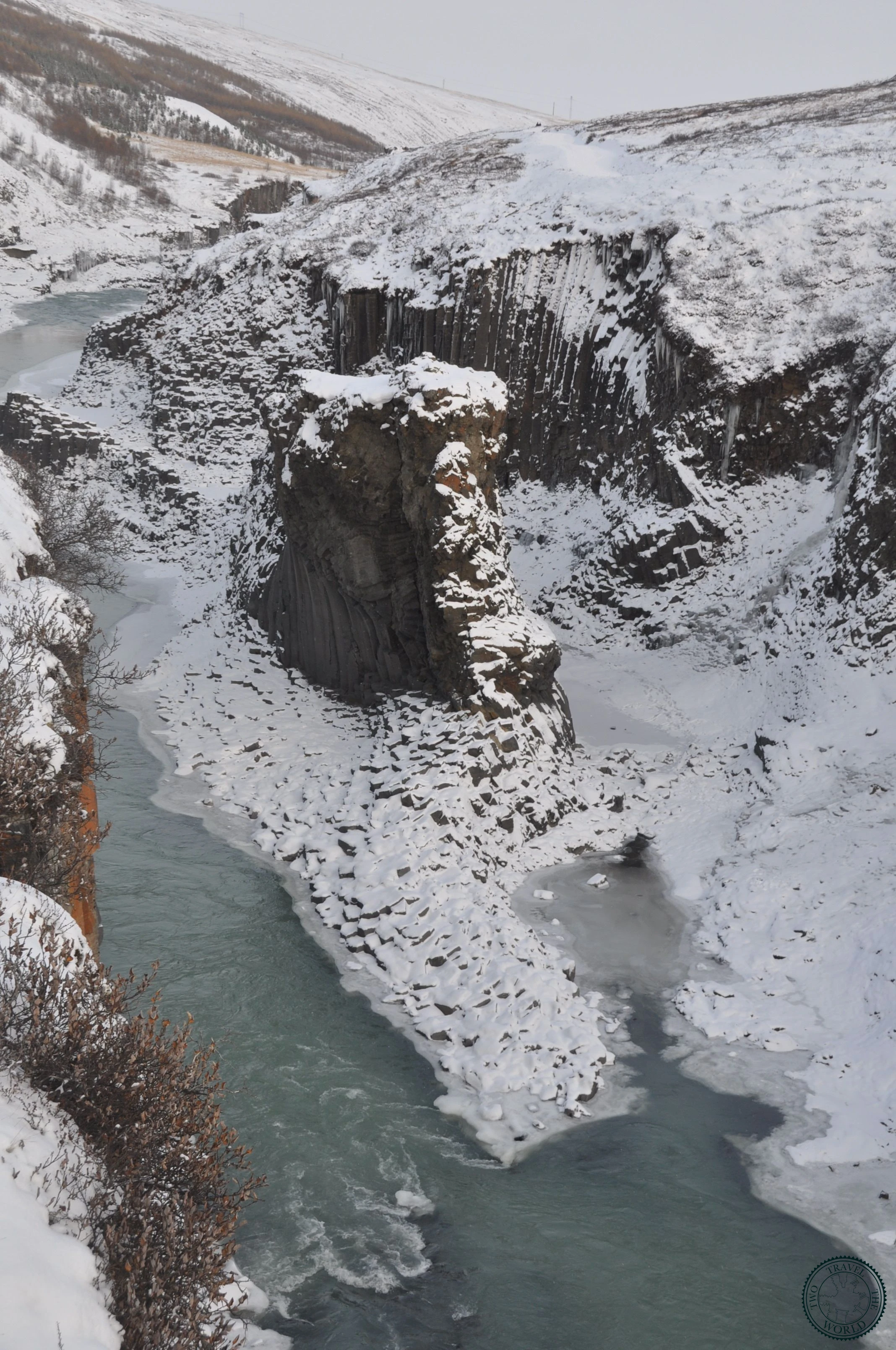
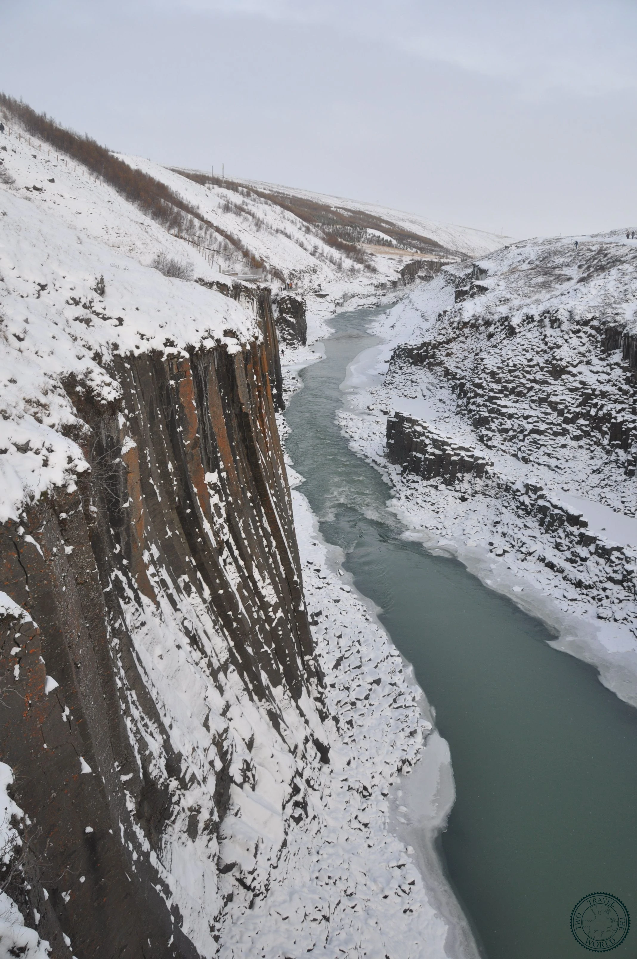
Stuðlagil Canyon was essentially hidden until 2009. Before the Kárahnjúkar hydroelectric dam was built upstream, the Jökla river ran too high and fast for the basalt columns to be visible. When the water level dropped, it revealed what might be the most impressive display of columnar basalt in Iceland — towering hexagonal pillars in shades of grey and rust, rising from river water that shifts between turquoise and milky blue depending on glacial sediment levels.
The canyon went viral on social media around 2019-2020, and it deserves every bit of the attention. We'd seen Reynisfjara's basalt columns by this point in the trip, and Stuðlagil still made our jaws drop. The columns here are taller, more uniform, and the turquoise water running between them adds a colour contrast that Reynisfjara's grey Atlantic surf can't match.
Getting there requires some effort — the canyon is remote, down gravel roads in the Jökuldalur valley — but that remoteness is part of what keeps it special. Even on a summer day, we shared the canyon with maybe 20 other people.
What to Expect
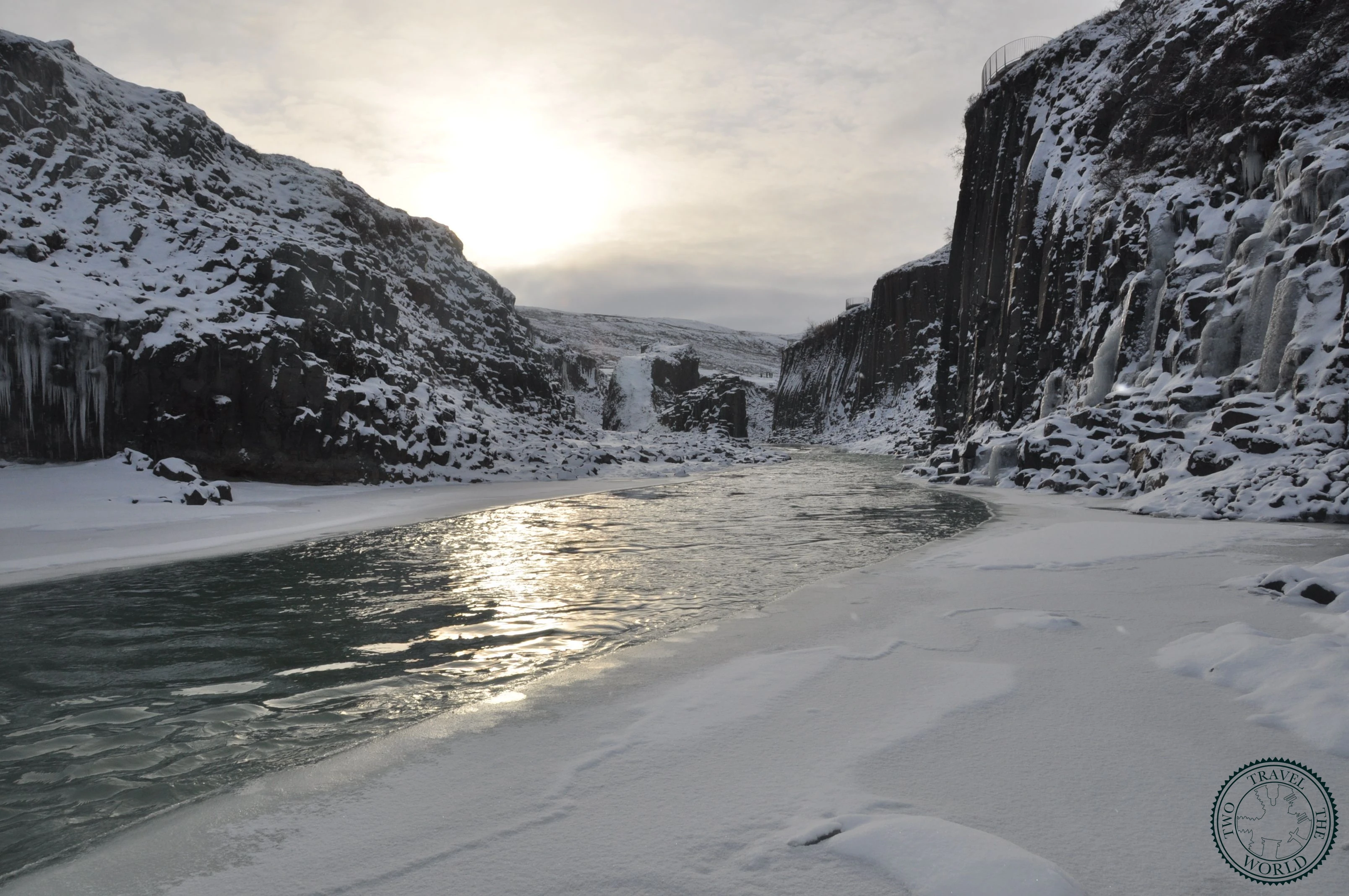
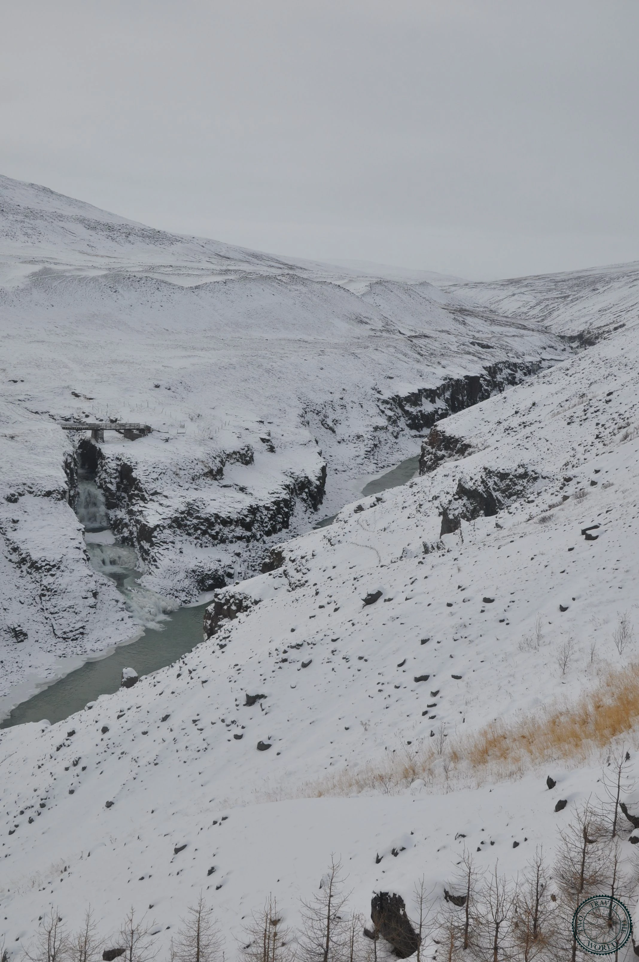
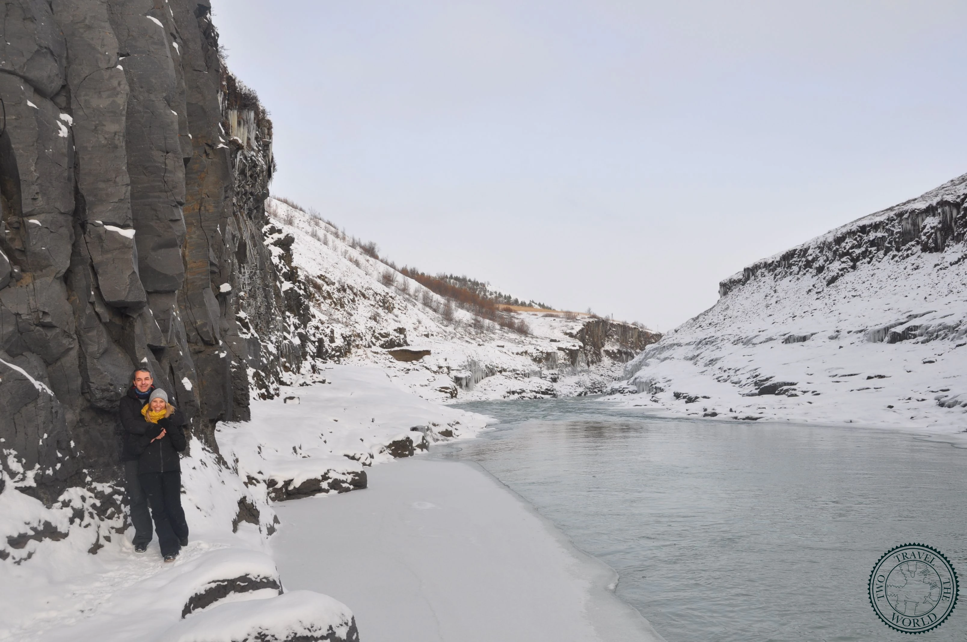
There are two approaches to the canyon, from opposite sides of the river. The east bank trail starts from a car park near Klaustursel farm and involves a roughly 3.5-kilometre walk each way along a well-marked path. This is the more popular route and the one that gets you closest to the famous viewpoint looking down into the canyon.
The west bank trail starts from a different car park and is shorter (about 1 kilometre each way), but stays on the canyon rim without river-level access. The views from above are still impressive, but the classic Stuðlagil photo — looking along the canyon walls from water level — requires the east bank approach.
We took the east bank trail and the walk was pleasant if a bit long. The path crosses farmland before dropping into the valley, and the last section involves scrambling down to the riverbed. The return walk felt longer because the novelty had worn off, but we were glad we committed to the full route.
Practical Tips
- Take the east bank trail from Klaustursel farm for the best views and river-level access
- The east bank hike is about 7 km round trip — allow 3-4 hours including time at the canyon
- Wear proper hiking boots; the riverbed scramble at the end is rocky and can be muddy
- The west bank is shorter but you won't get the iconic water-level photographs
- The turquoise water colour is best in summer when glacial melt is at its peak
- Getting there: turn off Route 1 onto Route 923, then follow signs to Stuðlagil — mostly gravel roads
- No facilities at either trailhead — bring water, snacks, and use toilets before arriving
- Visit in the morning for the softest light in the canyon; midday sun creates harsh shadows
- River levels can vary — after heavy rain, the water rises and covers the lower basalt columns
- Combine with Seyðisfjörður and Hengifoss for a full East Iceland day
Photo Gallery