Hengifoss
A 128-metre waterfall with distinctive red clay stripes
About This Experience
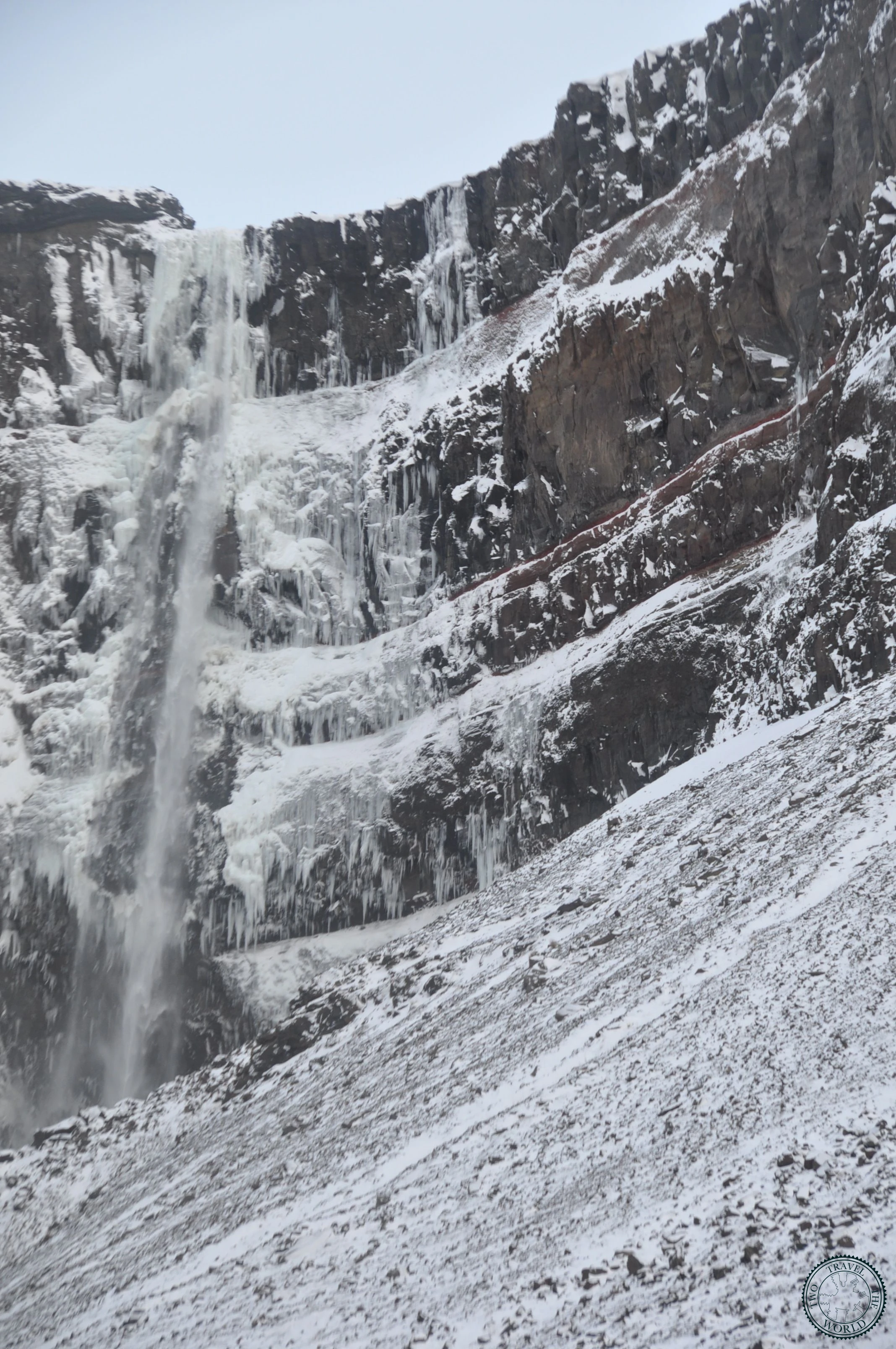
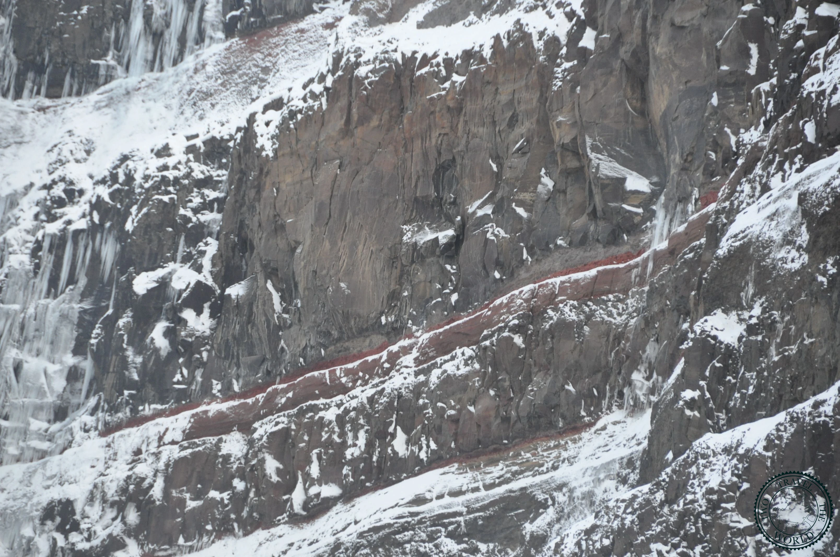
Hengifoss is Iceland's third-tallest waterfall at 128 metres, but what makes it stand out isn't just the height — it's the geology. The cliff face behind the falls is layered with alternating bands of dark basalt and vivid red clay, deposited over millions of years. The red stripes are ancient soil layers that formed between volcanic eruptions, and the visual effect is unlike any other waterfall in the country.
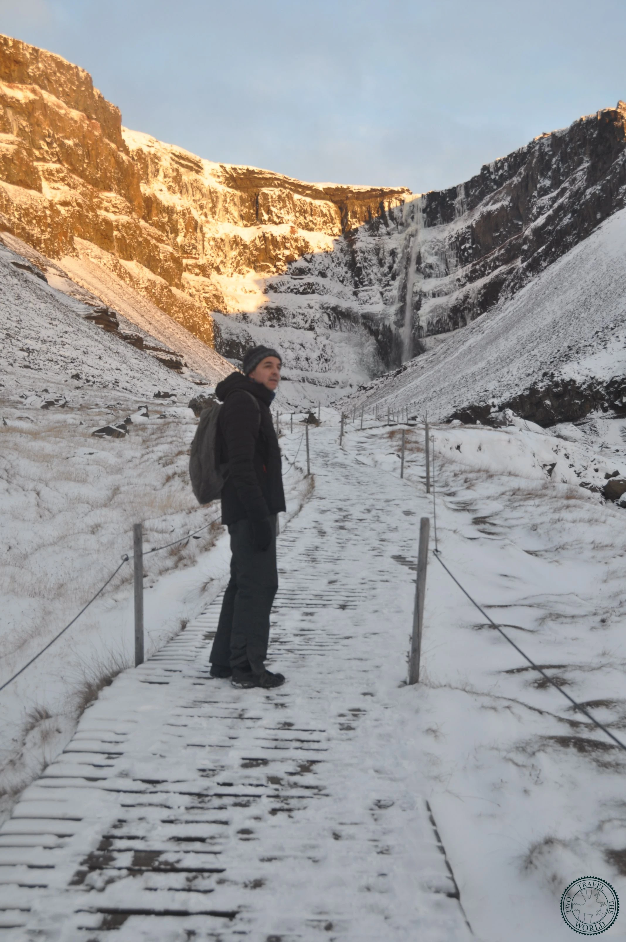
The hike to reach Hengifoss is part of the appeal. The trail climbs steadily for about 2.5 kilometres from the car park at Lögurinn lake, and about halfway up you pass Litlanesfoss — a smaller but arguably equally impressive waterfall framed by a perfect amphitheatre of basalt columns. Two waterfalls for the effort of one hike.
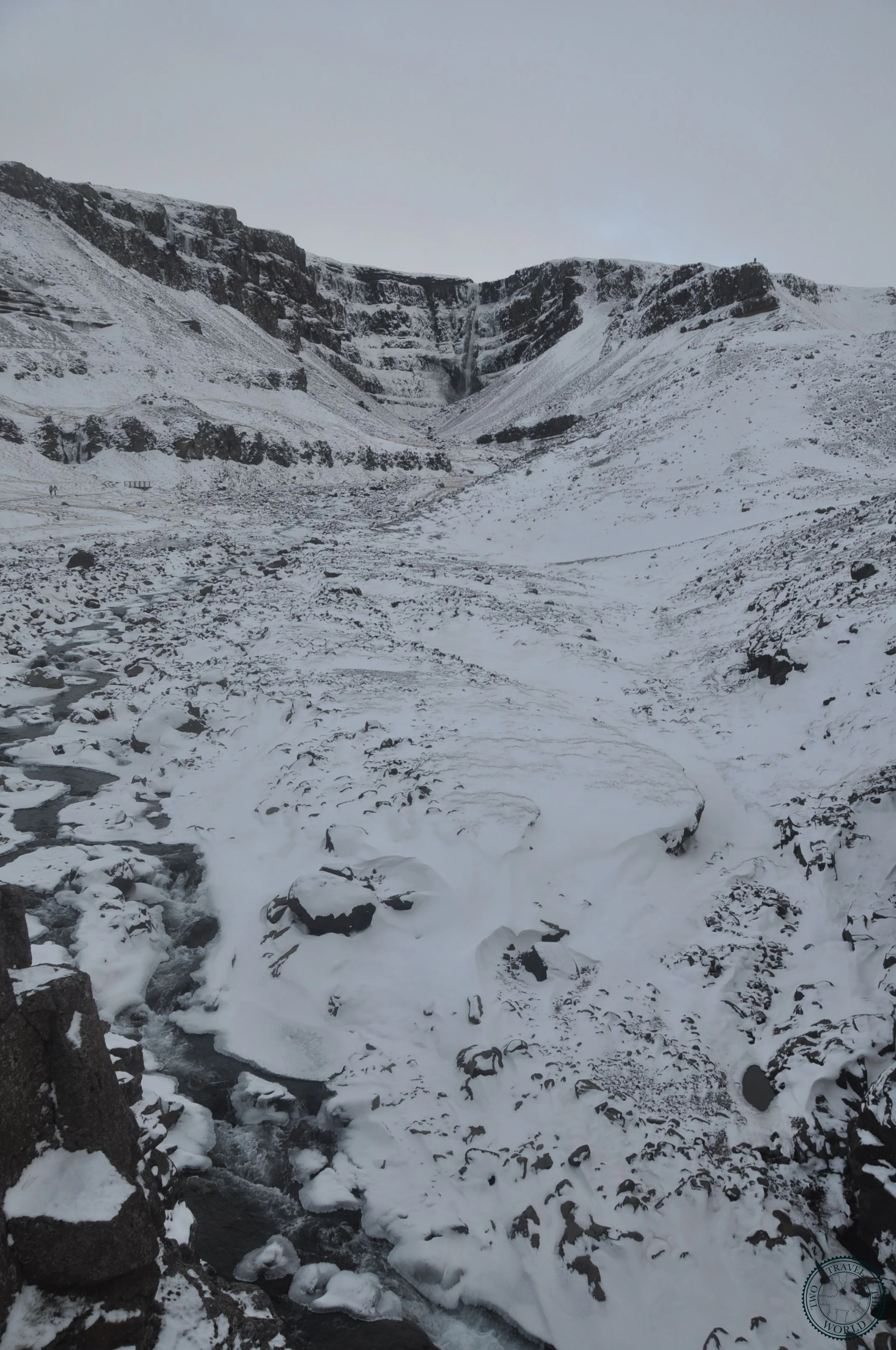
We visited on a day with patchy cloud cover, and the combination of light and shadow playing across the red clay stripes was mesmerising. The waterfall itself is a single thin stream when water levels are normal, which gives it an elegant, almost delicate appearance against the massive cliff face.
What to Expect
The trail starts at the car park beside Lögurinn (Lagarfljót lake), about 25 kilometres west of Egilsstaðir on Route 931. It's a steady uphill walk on a well-maintained gravel path with some steeper sections. The elevation gain is about 300 metres over 2.5 kilometres.
At roughly the halfway point, the trail reaches Litlanesfoss. The basalt columns here form a dramatic hexagonal frame around the waterfall, and it's worth spending 10-15 minutes taking it in before continuing upward.
The final approach to Hengifoss brings you into a natural amphitheatre. The waterfall drops from the top of the cliff into a plunge pool surrounded by the famous red-striped walls. A viewing platform at the base gives you the full effect. In windy conditions, the water stream gets blown sideways, creating shifting patterns against the rock face.
The return is the same path downhill, and moves faster. Total hiking time is about 2-2.5 hours at a comfortable pace with stops at both waterfalls.
Practical Tips
- The trailhead is at Lögurinn lake, about 25 km west of Egilsstaðir on Route 931
- The hike is 2.5 km each way with about 300 m of elevation gain — moderate fitness required
- Allow 2-3 hours round trip including time at both waterfalls
- Hiking boots recommended; the trail is well-maintained but has some steep, gravelly sections
- Don't skip Litlanesfoss at the halfway point — the basalt column amphitheatre is spectacular
- The waterfall is most impressive after rainfall when the water flow increases
- Morning light hits the red clay layers best, especially the upper sections
- No facilities at the trailhead — toilets and services are in Egilsstaðir
- Parking is free
- Combine with Stuðlagil Canyon for a full day of East Iceland highlights
Photo Gallery